Free for public projects

Collaborate on
Geospatial Data
— Like Code

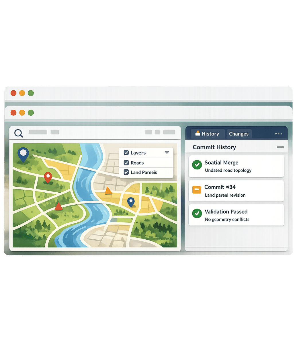
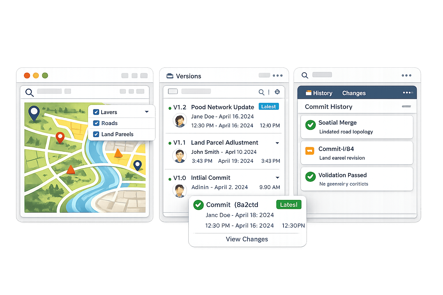
GISCollab is a version-controlled features for spatial data.

Pull, push, merge, and manage geospatial workflows across teams — online or offline.

Free for public projects. Private and enterprise plans available.

giscollab, GIS collaboration, geospatial version control, spatial data platform, GIS workflow, map collaboration, geospatial data management, GIS versioning, spatial data sync, GIS platform, collaborative GIS, remote sensing workflow, spatial data repository, map version control, GIS teams, geospatial cloud platform
Intelligent Merge

Merge spatial edits without breaking topology.

Offline Collaboration

Work locally and sync when reconnected.

Conflict Detection

Spot overlapping edits before they go live.

Spatial Versioning

Commit, compare, and recover GIS datasets.

HOW IT WORKS

A simple flow for
complex spatial teams

A commit-based workflow that feels familiar and practical for GIS operations.

01
Connect Your Data

Import GIS datasets from your tools or storage.

02
Collaborate & Edit

Work individually or as a team — online or offline.

03
Commit & Track

Save changes with version history and metadata.

04
Sync & Merge

Merge datasets and resolve conflicts instantly.

FEATURES

Version control primitives
for geospatial data

Pull & Push Data

Sync spatial datasets across devices and teams.

Spatial Commit History

Track every change with full version history.

Intelligent Merge

Merge datasets without breaking topology or structure.

Conflict Detection

Detect overlapping edits and resolve conflicts visually.

Offline Collaboration

Work without internet, sync when reconnected.

Real-Time Sync

Instant updates across team members.

Branching for Spatial Data

Create branches for experiments, scenarios, or regions.

Rollback & Version Recovery

Restore any dataset to previous states instantly.

Intelligent Relational Data

Maintain relationships between layers, attributes, and geometry.

Change Visualization

Visualize differences between versions (before/after maps).

Automated Data Validation

Detect geometry errors, missing attributes, inconsistencies.

Multi-Format Support

Supports raster, vector, LiDAR, CAD, and more.

PLATFORM PREVIEW

Built for modern geospatial collaboration

Manage spatial workflows with version control, collaborative editing, and GIS-aware data operations.

Versioned Spatial Data

Track changes across maps, layers, and attributes.

Collaborative GIS Workflow

Enable teams to sync edits in real-time.

Offline & Conflict Resolution

Continue working offline and resolve conflicts visually.

Explore platform
giscollab, GIS collaboration, geospatial version control, spatial data platform, GIS workflow, map collaboration, geospatial data management, GIS versioning, spatial data sync, GIS platform, collaborative GIS, remote sensing workflow, spatial data repository, map version control, GIS teams, geospatial cloud platform
USE CASES

Built for teams moving
real-world data

Field Survey Teams

Work offline on-site and sync updates later.

GIS Analysts

Track spatial changes across multiple datasets.

Infrastructure Planning

Manage evolving construction and utility data collaboratively.

Research & Academia

Share and version geospatial datasets for studies.

Start public, scale private

Clear plans for open projects, professional teams, and enterprise infrastructure.

Free

For open geospatial work

$0 /month
  • 5 public projects
  • Basic collaboration
  • Community support
Get Started

Pro

For evolving teams

$29 /month
  • Private projects
  • Advanced merge & sync
  • Plugin access
Start Pro

Enterprise

For organizations

Custom
  • Unlimited projects
  • Team management
  • Dedicated infrastructure
Contact Sales
FAQ

Questions before the first commit

GISCollab is a collaborative features for managing and versioning geospatial datasets like code.

GISCollab is built specifically for spatial workflows, topology, and GIS collaboration.

Yes. You can continue editing locally and sync changes once internet access returns.

GISCollab supports common GIS formats including GeoJSON, Shapefile, GeoPackage, and more.

Yes. Public projects can be used for free with optional paid plans for advanced workflows.

Yes. GISCollab is designed to integrate with existing GIS software workflows and plugins.

Ready to collaborate on spatial data?

Build, manage, and version geospatial workflows together with modern Git-inspired collaboration.